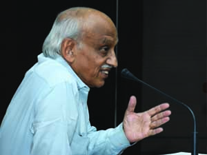
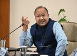
 Kiran Kumar.jpg
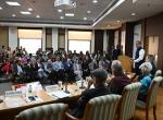
On 17th January 2020, Vivekananda International Foundation (VIF) held its monthly ‘Vimarsha’ lecture series on the important subject of India’s Space Programme. Dr A.S Kiran Kumar, former Chairman ISRO, was invited to speak on the opportunities, challenges and perspectives on Indian Space missions. Dr Kiran Kumar is presently Vikram Sarabhai Prof at ISRO and a member at Space Commission as well as Governing Council of Indian Institute of Science.
Dr Arvind Gupta, Director, VIF, commenced the evening by acknowledging ISRO as a jewel in India’s crown. He further alluded to India as a major space power and contributing to nation’s development, security and morale. He briefly highlighted the achievements by ISRO in the year 2019.
Dr Kiran Kumar began his presentation by revisiting an incident from the days when ISRO launch its first rocket. Dr Vikram Sarabhai at that time had convinced the fishermen to vacate thumba equatorial rocket launching site by promising them the welfare of the entire country in future. This was later proved to the fishermen in 1999, when India was able to provide them specific information on prospective fishing zone identification in 7,500 km long coastline of the country. This is also the birth centenary year of Dr Vikram Sarabhai, father of India’s Space Programme, which ISRO is celebrating from August 2019.
The Indian Regional Navigation Satellite System (IRNSS) has been another recent development by the ISRO in this direction. India’s is only a seven-satellite constellation which is different from other navigation systems. The system is installed in a gadget that is connected to a fishermen’s mobile handset to enable him to navigate to a prospective fishing zone in the vast oceans. Apart from this information he is alerted for rough weather at sea or when he is approaching an international boundary. Additionally, the communication is done in the fisherman’s mother tongue. Hence, this provides a very unique solution to fishermen’s problems solved by an equally unique NAVIC system with an advanced messaging system.
In 1975, India conducted the largest socio-technological experiment under Dr Sarabhai. This experiment was to demonstrate how satellite broadcasting can be used to disseminate information to very remote areas of our country with the help of an American Satellite ATSF. Another very unique achievement was that three independent functionalities of broadcasting, telecommunication and meteorology were brought into a single satellite for the first time. Today we have progressed to a satellite which provides 11GB capacity even as it will benefit the Gram Panchayats and other rural bodies. Another communication satellite has been launched by India whose transponders are made available to some of the Asian countries. These countries have appreciated the way India has fulfilled its promise and in a short time. Dr Kumar has indicated the launch of a high throughput satellite this year, which will cover the entire Indian subcontinent and improve our capacity to 100 GB.
Gagan and NAVIC have been important developments in the overall navigation services to the country. DGCA has made it mandatory for all the aircrafts manufactured after January 2019 to carry the Gagan receiver that will help them in route planning and develop the precision landing capability. Qualcomm and another company have been working to bring out NAVIC enabled systems. Our meteorological satellites have been another success story with the inclusion of micro-wave satellites. These are the satellites which penetrate through clouds to pick up information about ocean wind vectors and are made available to international organization as well. The India Meteorological Department (IMD) is using Indian satellites to predict super cyclones, which have had disastrous effects in the past.
Dr Kiran Kumar made reference to our remote sensing capabilities. These satellites that enable us to look at India and its surroundings, have evolved from 1km resolution 28-30cm resolution provided by Cartosat-3. Alongside, India has established hyper spectral imaging capabilities from space. We have generated a Digital elevation model for India as well as the region, which provides data useful for various purposes including urban planning. Large number of application capabilities provided by space technology is being used in various departments across the government. Under the Geo-MGNREGA project, more than 4 crore assets/activities have been geo-tagged for the people and government to see what is happening in their surroundings and planning future activities.
In the domain of space science, we have demonstrated our capabilities ranging from the Low Earth Orbit at 500-900km to Martian orbit at 225 million km. One of the most unique developments has been the Astrosat which carries a telescope with a resolution three times better than the best in the world. It has already produced lot of original scientific results in relation to black whole, mars observation and more. Similarly, the data which we are capturing from the lunar surface after Chandrayaan1 and 2, is going to be a very useful input for all our future lunar missions. This is where Dr Kumar also introduced the mission to carry Indian ‘gaganauts’ to space by India’s 75th year of Independence. A new centre for this mission has been established in Bangalore, in collaboration with a host of Indian entities like DRDO, Aviation entities, academic institutions as well as industrial support.
Dr Kumar highlighted our realization of fully indigenous processor chips in the country. The 180 nanometer foundry in the country makes processor chips in the country which are operational in our launch vehicles. The latest development has been that of the ‘Vikram’ processor.
After Chandrayaan-1 and thereby demonstrating our capability to build synthetic aperture radar and fly them, India has gained recognition from all over the world. With this ability, ISRO has got on board with NASA on the NISAR mission. It is $1 bn dollar project where India is spending $0.1 bn and building a portion of the payload. The mission objectives are to detect surface deformation, biomass estimation, ice dynamics monitoring, among others, over the surface of the earth. This payload is presently being experimented over the South and North American region. Through this, Dr Kumar indicates that India is at a par with the best in certain technologies, even with the given resource constraints.
Acknowledging the drastic increase in the number of active space-fearing nations around the globe, Dr Kumar drew our attention to the problem of space debris. With 12,000 operational satellites in Low Earth orbit (LEO), there is approximately 18,000 pieces of trackable debris bigger than 10 cm. In medium Earth orbit (MEO) there are 150 operational satellites, with approximately 1,000 pieces of trackable debris. And in GEO, 550 operating satellites function with approximately 1,000 pieces of trackable debris. More and more private enterprises are entering this domain with the aim of launching large satellite constellations. To counter this threat, a collision probability analysis is carried out before a satellite is launched and while its in space, to be able to maneuver it accordingly. Simultaneously, technology development and compliance measures will be equally helpful to this cause.
The progressive militarisation of space, has made it important for nations to develop these capabilities unless they want to remain peripheral actors. The number of satellites used for military purposes is a big number today. Also, the problem of energy using space can be solved by illumination to a specific area on the ground by manipulating a large reflecting surface from space. Lot of experiments are being carried out to find an economically viable programme to convert sunlight into electrical power and beaming it down onto earth. Today, China is a dominant player in using the outer space to generate solar and other forms of energy. Nations are aiming at energy maneuverability dominance using space sourced propellant.
Space tools have been identified as are highly relevant for the attainment of all 17 Sustainable Development Goals, either directly, as enablers and drivers for sustainable development, or indirectly, as an integral part of the indicators for monitoring the progress towards the implementation of the 2030 Agenda for Sustainable Development.1
India is said to have demonstrated utility of space programme. However, the challenges unique to the country, as identified by Dr Kiran Kumar, include the need to engage academia and industries to come up with innovative and economic space solutions. Being amongst the few countries with end to end capability, he suggests that its India’s responsibility to ensure that the technology development is accessible to entrepreneurs. This can contribute to reduction in cost of access, especially for the lesser developed countries where this technology can be commercialized.
The presentation was followed by the Q&A session. Herein, the function of International Space Station was discussed. Speaker highlighted ISS’s service to humanity and how it has enabled learning about human survival in space and micro-gravity substances, among other things. In another instance, he also elaborated on Aditya or India’s solar mission, which will provide an ability to look at sun beyond photosphere up to 3 times the solar radii and capture long term observations in events such as total solar eclipse and help in other future experiments. Other topics of discussion included space militarisation, UFOs, the environmental impact of space activities and the landing of Chandrayaan-2.
- Simonetta Di Pippo, Director of the UN Office for Outer Space Affairs, June 20, 2018, UNISPACE+50 High-Level Segment.
-

On 20 March, 2025, VIF hosted a delegation from Uganda led by Amb
-

On February, 10 2025 the Vivekananda International Foundation org
-

On January 20, 2025 the Vivekananda International Foundation orga
-
On 07 March 2025, the Vivekananda International Foundation (VIF)
-
On February 25, the Vivekananda International Foundation (VIF) or
-
On February 24, the Vivekananda International Foundation (VIF) or
-

On March 3, 2025, the Vivekananda International Foundation (VIF)
-
In an era defined by rapid technological evolution, the integrati
Post new comment