The unanimity with which the Rajya Sabha and Lok Sabha finally, on May 6 and 7 respectively this year, passed the Bangladesh-India Land Boundary Agreement, 1974 and the Protocol thereunder of 2011 was indeed a historic, game-changing development in the tortuous post-Partition annals of this fragmented sub-continent. It finally put to rest some of the demons released by the Radcliffe Award that drew the lines across the map partitioning the historic geo-political configuration that used to be India until August 14, 1947. The Land Boundary Agreement of 1974 was entered into by the then Prime Ministers of Bangladesh and India, Bangabandhu Sheikh Mujibur Rahman and Shrimati Indira Gandhi, on 16th May, 1974. That Agreement laid down the principles of demarcating the borders that the Radcliffe Award had bequeathed to the two sides. The Protocol under that Agreement executing the directives of that Agreement and the modalities of transfer was signed by Prime Minsters Sheikh Hasina of Bangladesh and Dr. Manmohan Singh of India when the latter visited Bangladesh on September 6-7, 2011. In a sense, it was entirely appropriate that the daughter could complete what the father had envisaged over 41 years ago but could not complete because he was so tragically and brutally assassinated a little after a year of his signing the accord.
When the Partition of India took place at Independence in August 1947, marking end of British colonial rule of the sub-Continent, under the Radcliffe Award that divided the sub-continent India shared its longest land border of 4096 kilometres with what emerged as East Pakistan on August 14, 1947. This was a tortuously complex border, partitioning not just what had constituted one historical geo-political entity for millennia, but also cutting mercilessly across communities that had coexisted together for centuries, and indeed households that had been one the night before. Apart from the sheer length of the border, some cutting across rivers, the division also unwittingly spawned some strange creatures: (1) enclaves of one country within the newly constituted national boundaries of the other (East Pakistani enclaves surrounded on all sides by Indian territory, and vice versa), in which the inhabitants were notionally citizens of the new countries to whom the land belonged, but totally isolated by virtue of their location, as the new country to which they found themselves belonging by virtue of the Partition could not reach governance or services to their notional citizens while the national entities which now found themselves saddled with these enclaves refused to acknowledge these people as their own: and (2) adversely possessed lands (lands in possession of one or the other newly carved national entities which, under the award were arbitrarily endowed to the other side, whether deliberately or inadvertently because the pen drawing the line on the map had a very thick nib).
Post-Partition efforts at demarcation under the Noon-Nehru accord of 1958 was unable to resolve these festering issues (was it because the then West Pakistani Establishment had linked it to their own disputes along the Western borders?). Although border demarcation work proceeded with the Surveyors General of the two new national entities carrying on demarcation as per the line drawn across the map by Sir Cyril Radcliffe, the strip maps continued to remain “unformalized” by the Plenipotentiaries of the two sides not signing on to them – again whether it was deliberately so left, or benign but well-intentioned on the assumption that all strip maps would be formally signed as accepted at one go when the formal ratification of the borders would be concluded, is a matter now also for conjecture. It may be noted that not getting the Plenipotentiaries to counter-sign the strip maps agreed upon by the respective Surveyors General left a dangerous situation for mischief, because either side at any given point of time could contest that the demarcation done had been inaccurately or correctly. Indeed, such a situation did arise in mid-1995, but was narrowly averted.
When I took over as Additional Foreign Secretary for South Asia and SAARC in March 1995, there were some 65 kilometres of the 4096 km long border still undemarcated. When I returned as High Commissioner to India in August 2009, I found there was still 6.5 kms of the border (Daikhata: 1.5 km; Lathitila-Dumabari: 3 km; Muhuri River: 2 km), as well as numerous enclaves (111 Indian enclaves within Bangladesh territory with some 34,000 inhabitants and 51 Indian enclaves inside Indian territory with about 15000 inhabitants) numerous and Adversely Possessed lands (APLs) on which agreement had not been reached. Empowered by the visionary leadership of both countries, the two sides set about in earnest to implement the Indira-Mujib Accord of 1974 in spirit and letter.
Keeping the welfare of the virtually “stateless” state of the inhabitants of the enclaves, the two sides conducted an enumeration survey, with numerous teams comprising Observers, Supervisors and Enumerators to visit each and every enclave and record the relevant particulars of their respective inhabitants. Both sides assumed that when actual transfer of enclaves took place, there might be a small percentage of the inhabitants on both sides who might not wish, for emotional reasons, to remain citizens of the countries absorbing their respective territories. Having such a list of the population would help both sides in arranging for their migration and rehabilitation in such an eventuality.
Simultaneously, the respective High Commissioners of the two countries were empowered as Plenipotentiaries to countersign all the strip maps pertaining to the demarcated borders. There were several thousand such maps on both sides (maps of alternating strips of the boundary with each side), and each had to be signed in quadruplicate. The earliest demarcated strip map dated back to 1952. All these separate exercise were completed by August 2011.
The entire process was extremely complex and by no means easy, as various local conflicting interests and sometimes viscerally antagonistic opposition at different levels had to be dealt with, pacified and won over. I must pay tribute here to the various officials on both sides, who went into the field to carry out the job entrusted to them by the leadership of the two sides. Whenever difficulties were encountered, the field officials were given full support and backing, and clear instructions by the chain of command at all levels as was required. Without all this coming together, this feat could not have translated into the miracle it ultimately turned out to be.
Historically, undemarcated borders between neighbours have been the cause of spawning or aggravating other areas of disputes, just as land disputes between members of the same family or community can spiral out of control and result in creation of bad blood. Conversely, resolution of such contestations also translates into restoration of harmony, whether within the family, community or between nations. The resolution of this long festering problem has already, according to first reports been welcomed by a vast majority of the peoples on both sides, irrespective of internal political divisions. It has already prised apart the space of mutual comfort and mutual trust that are essential prerequisites for cooperation and collaboration in any activity. It demonstrates palpably to one and all that even the most difficult or intractable of disputes can be resolved amicably given goodwill and sincerity on both sides.
Above all, without visionary leadership on both sides that eschewed narrower political considerations in the interest of the larger common good, this would not have been possible. This resolution stands out as an exemplar of visionary statesmanship, common sense, and pragmatism and signals that other such festering disputes can also be addressed with reason and goodwill, for the greater common good of the people, whether of countries or regions.
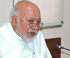
Ambassador Tariq Karim was High Commissioner of Bangladesh to India from August 2009 to October 2014. He is currently Distinguished Fellow at the Vivekananda International Foundation, New Delhi.
Published Date: 11th May 2015, Image Source: https://globalvoicesonline.org






Post new comment